Press Releases
Montgomery County’s New Flood Risk Explorer Identifies Flood-Prone Areas
For Immediate Release: Tuesday, December 9, 2025
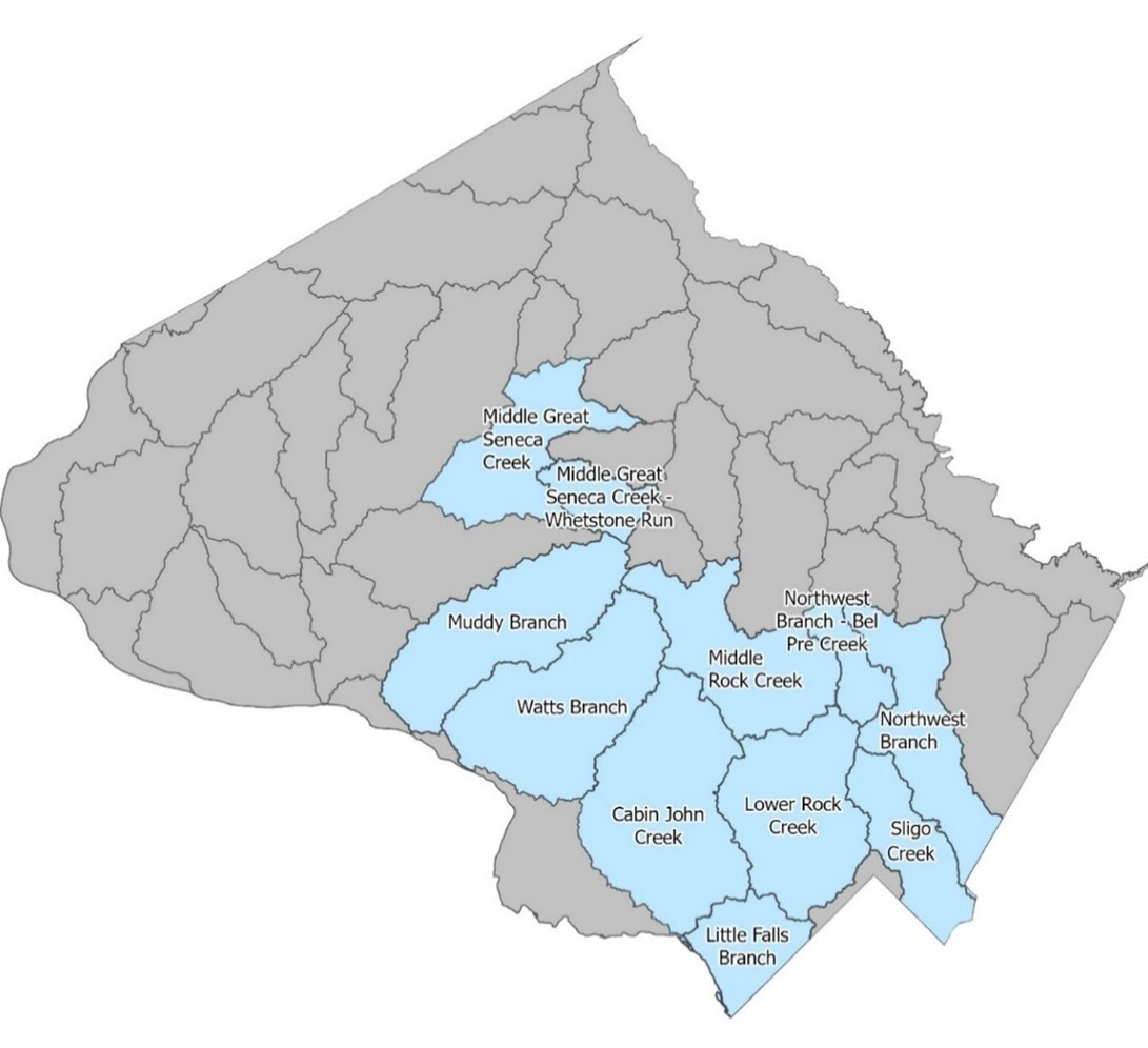
Montgomery County Executive Marc Elrich announced the release of the County’s new Flood Risk Explorer, a map that identifies flood-prone areas in the Sligo Creek area/watershed. The tool, available on the County’s flooding website, highlights areas of the Sligo Creek watershed that have a higher risk of flooding during extreme rainstorms now and in the future. While Sligo Creek is the first watershed mapped in the Explorer, 10 more watersheds will be modeled in the coming years.
“There is no doubt that climate change is causing heavier and prolonged periods of storms that bring severe and even deadly consequences,” said County Executive Marc Elrich. “This map is a useful tool for County residents and businesses to see how their properties could be impacted by these devastating storms and the flooding they cause. While the County will be expanding its activities to address flooding, everyone can take steps to reduce their flood risk before the next big storm happens.”
The Flood Risk Explorer can help residents understand the relative risk of flooding in their home, neighborhood, and commute, so they can take action and stay safe from flooding.
All County residents can benefit from information available on the County’s flooding website.
The County has outlined simple actions for people to know:
- Be weather aware.
- Consider flood insurance.
- Know your flood risk.
- Plan and protect your home or business.
- Sign up for Alert Montgomery.
The Flood Risk Explorer is part of the Comprehensive Flood Management Plan (CFMP), a multi-agency effort designed to improve the County’s ability to prevent, prepare for, respond to, and recover from flooding.
The County addresses flooding and flood emergencies using many different tools:
- The County has installed 40 flood sensors in high-risk areas, including three in the Sligo Creek watershed. These sensors, monitored by the Office of Emergency Management and Homeland Security, alert public safety agencies to rising water levels, allowing for proactive road closures during floods.
- The Montgomery County Department of Transportation operates the County’s Storm Operation Center, which activates ahead of emergencies to position highway crews, monitor conditions, and respond quickly to weather events to protect public safety.
- Flooding should be reported to MC 311 or the non-emergency police line at 301-279-8000 after hours. Reports are shared with response teams, and the public is updated through social media and emergency alerts. Since many flooded roads lack sensors, residents are strongly advised: "Turn around, don’t drown." Never drive through flooded roads.
Flooding is the most frequent severe weather event and the costliest natural disaster. Floods not only affect high-risk coastal areas but according to the Federal Emergency Management Agency (FEMA), 25% of flood insurance claims come from moderate-to-low-risk areas like Montgomery County. Just one inch of floodwater can cause up to $25,000 in damage.
Visit the County’s Flooding website for more information. Subscribe to Alert Montgomery to receive emergency alerts from Montgomery County directly to your mobile devices.
# # #
Media Contact: Cindy Peña 202-875-1563
Categories: Environment